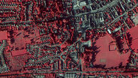
Aerial Photo & Height Data for APGB Members

Order Data
As an APGB member you can log in to our dedicated APGB Mapshop, search for your required area and order aerial photography, Digital Terrain and Surface Models.
Orders less than 1500 sq kms can be downloaded, larger orders will be delivered on hard drive or USB stick within 15 days.
Please note: your login details to the APGB website do not automatically work on the APGB Mapshop – you need to set up both accounts
A Bit About APGB
APGB (Aerial Photography for Great Britain) comprises aerial photography and height data (DTM and DSM), for government. The data itself is captured, processed and delivered by Bluesky International Ltd, on a rolling two year update programme. The data is available to APGB members through a web delivery portal for download or delivery on hard drive, or via a Web Mapping Service (WMS).
This website has been set up to bring you information about the data, the ongoing capture and to enable you to order, ask questions and share experiences using APGB data. The team is here to help you make the most of these most valuable data sets.


